Pamet Harbor, Truro MA. USA | L Brady

I’ve been working on a short film, First Encounter, about the Mayflower landing, in 1620. It will document the first month after the Pilgrims arrived; from their landing off the coast of Provincetown to the founding of the settlement in Plymouth. If you’re interested in the topic, pick up a copy of Nathaniel Philbrick’s book, Mayflower.

I’ve been traveling lower Cape Cod, scouting film locations. Here’s a few shots of Pamet Harbor, named Cold Harbor by the Pilgrims. It resides at the end of the Pamet River. The Pilgrims deemed it too shallow for a permanent settlement.

These shots were taken with a Canon 5D Mk II and Canon 70-300mm f4-f5.6L IS USM.
IMG_0105_realreality productions_2015_12_11

IMG_0094_realreality productions_2015_12_11

IMG_0110_realreality productions_2015_12_11

IMG_0097_realreality productions_2015_12_11

IMG_0107_realreality productions_2015_12_11

IMG_0109_realreality productions_2015_12_11

Cairo, Egypt | Seosamh Mac Giolla Phádraig

Despite the advice from my government and even Egyptian colleagues, I stubbornly persisted with my plan to visit Cairo in mid-December 2014 and while my safety was never compromised it was hard to ignore the paranoia in the dictatorship of Abdel Fattah Saeed Hussein Khalil el-Sisi.
Tourism was down 80 percent since the beginning of the Arab Spring which destabilized the whole region so those working in tourism were desperate for support. The only silver lining for a tourist in such an environment of desperation and fear is that key sites are easy to access. The Egyptian Museum has more unadmired mummies than a Pharaoh could shake his crook at while even the King’s Chamber of the Great Pyramid lies empty near the close of the day. Hearing my lone voice echo in this amazing space will doubtless be the highlight of my touristic life. Seosamh Mac Giolla Phádraig

See more of Seosamh’s work @ https://www.flickr.com/photos/dublinroad/albums

001001 – Government forces primed and ready for action outside the Egyptian Museum which lies next to Tahrir Square where Egyptians gathered in 2011 to topple the dictatorship of President Hosni Mubarak and where Egyptians gathered in 2013 to bring down the curtain on the short-lived democratically elected government of Mohamed Morsi.

002002 – The Egyptian Museum on Wasim Hassan which is currently undergoing a major restoration befitting of its magnificent collection of priceless artifacts.

003003 – The minaret of the Al-Fath Mosque on Midan Ramsis which is one of Cairo’s greatest landmarks.

004004 – In Cairo’s most famous souq area, Khan El Khalili, lies the stunning Qalun Mosque.

005005 – Children enjoying an evening game of pool by the sidewalk in the neighborhood surrounding the walls of Salah El Din Citadel.

006006 – A breathtaking view as dusk descends on the impoverished neighborhood between Salah El Din Citadel and Sultan Hassan Mosque.

007007 – Sand and sky frame the Pyramid of Menkaure and Pyramid of Khafre at the Giza Necropolis.

008008 – The Great Sphinx stands sentinel to the Great Pyramid at the Giza Necropolis.

009009 – The architecturally interesting burial chambers in the Greek Orthodox Cemetery in Coptic Cairo.

010010 – The view from Cairo Tower of the lush greenery by the Nile reminds one of the Nile’s essential role in the agricultural life of Egypt past and present.

© 2015 Seosamh Mac Giolla Phádraig

Saint Petersburg, Russia | Seosamh Mac Giolla Phádraig

Founded by Tsar Peter the Great in 1703, Saint Petersburg is the cultural heart of the Russian Federation and a city synonymous with the three revolutions which shaped 20th century Russian and ultimately world history. The city continues to thrive economically and culturally and is the political heartland of the Federation’s current leadership. Seosamh Mac Giolla Phádraig

See more of Seosamh’s work @ https://www.flickr.com/photos/dublinroad/albums


001001 – The south side of the magnificent Catherine Palace in Tsarskoye Selo (Pushkin), 25 km south of St. Petersburg. The Catherine Palace is famous for being the summer residence of the Russian tsars.

002
002 – The gilded onion domes of the Catherine Palace in Tsarskoye Selo which has been completely restored since its destruction during World War II.

003
003 – Pigeons in the charming Catherine Park in Tsarskoye Selo (Pushkin) close to St. Petersburg.

004
004 – A carriage dashes through the snow in the Aleksandrovskiy Park in Tsarskoye Selo (Pushkin).

005
005 – A statue of beloved Russian poet, playwright, and novelist Alexander Sergeyevich Pushkin in the grounds of the Catherine Palace.

006
006 – The facade of the Winter Palace in St. Petersburg. The Palace was the official residence of Russian monarchs from 1732 to 1917.

007
007 – Palace Square in St. Petersburg which is the city’s main square and the scene of the most tumultuous moments in 20th century Russian history.

008
008 – A large urn in the Hermitage Museum which is one of the oldest museums in the world.

009
009 – The Church of the Savior on the Spilled Blood located on Griboyedov Canal Embankment, is one of the most stunning churches in St. Petersburg.

010
010 – The Grand Ducal Burial Vault and Peter and Paul Cathedral in the Peter and Paul Fortress.

011
011 – Smolny Cathedral by the banks of the River Neva.

012
012 – The Kunstkamera Museum from across the Bolshaya Neva on Admiralty Embankment.

© 2015 Seosamh Mac Giolla Phádraig

Getting your ducks in a row at Lake Winnipesaukee, Weirs Beach, NH. USA | L Brady

Screen Shot
click for a larger view

Lake Winnipesaukee, N.H. is a beautiful natural location about 2 hours North of Boston, Massachusetts.

New Hampshire is replete with fresh water lakes. Lake Winnipesaukee is the largest. The lake is 9 1/2 miles wide and 28 miles long.

Camping, hiking, swimming, boating are only a few of the things you can do in this lovely location.

Find out more at the following links:
http://www.lake-winnipesaukee-travel-guide.com/
http://www.winnipesaukee.com


I traveled to the Lake in November 2104. It was a cloudy day but I took a few interesting shots. I usually only do minor manipulation to my photos but, in this case, I used Photoshop to manipulate the shadows and highlights. I find the images a bit painting – like but …

I’m using the Canon 5D mkII now and like the results it produces, very much.  But it still doesn’t beat film. ;-)


Get Your Ducks in a Row_LBRADY
Ducks in a row on Weirs Beach, N.H. – Canon 5D MKII at 20mm, f8 at 1/250 at ISO 100


Gaza_NH_LBRADY
Gaza, N.H. – Canon 5D MKII at 20mm, f6.3 at 1/160 at ISO 100


2014_11_13_IMG_0184
View East from Weirs Beach N.H. – Canon 5D MKII at 20mm, f8 at 1/250 at ISO 100


Creative Commons License

All work on this site by Leo Brady  is licensed under a Creative Commons Attribution-ShareAlike 3.0 Unported License.
Permissions beyond the scope of this license may be available at realreality productions

Wander, Wonder, Wilderness at the Institute of Contemporary Art, Boston at 7pm on Saturday 9/20, with a matinee on Sunday 9/21 at 3pm

60521259-457d-47cc-9167-ddb5e789d511


FILM

Wander, Wonder, Wilderness


Interactive documentary project Wander, Wonder, Wilderness explores the relationships between humans, community, and nature—and the ways that green spaces serve as an antidote to our de-natured lives. Participants are invited to visit Boston’s natural spaces, create content including text, images, and sound, and share it with future visitors via an interactive website and app. Project director and artist Paul Turano will kick off the project at the ICA with a documentary screening. For more details and how to participate,

visit wanderurbanwilds.com.


Dear Friends and Supporters

I want to remind you about the premiere screening of Wander, Wonder, Wilderness at the Institute of Contemporary Art, Boston at 7pm on Saturday 9/20, with a matinee on Sunday 9/21 at 3pm.

I hope to see you there!

Please visit the ICA website for more info and to purchase tickets and RSVP on our Facebook page. Please note that tickets at the door are $8 students and $12 general public.

Check out press on WWW in the Boston GlobeIMAGINEi-DocsStoryCode!

Like us on Facebook
Follow us on Twitter @wanderwilds
and share photos and captions on Instagram: #wanderurbanwilds

And please consider supporting us financially…details of our forthcoming Kickstarter campaign will be announced soon!

Both ICA presentations will include an overview of these interactive features and the project’s community engagement and educational initiatives, along with a Q+A with the audience. Attendees will have a unique opportunity to sign up to be the first users of the beta version of the mobile app!

                                         www.wanderurbanwilds.com

Contact PaulTurano@gmail.com for more information.

Please help spread the word!


Wander Wonder Wilderness Project | Boston MA USA

d9f7a48017df11e3adbc22000a9e17d5_7About

The human experience of nature through urban wilds is multifaceted, as it can involve not just our appreciation of plants, trees, animals, birds, and phenomena of light and weather, but the more personal interactions and internal ruminations that these environments inspire. These excursions into nature are also a journey through history, as the landscape contains the residue and evidence of previous eras. From geological origins, the first habitation by Native Americans and subsequent European settlement, to the dramatic physical alterations that occurred throughout the 19th century, and the rapid industrialization and high-rise urbanity of the 20th, the artifacts of all these eras are evident upon contemplative bipedal observation. Wander, Wonder, Wilderness will capture how a simple walk through an urban wild can provide an opportunity to engage with the philosophical, socio-cultural, and economic complexity of the ever-changing relationship of humans to the wilderness.

My own personal experience with these locations will be documented in a long form essay film, where I chronicle the insights these spaces have provoked. A companion interactive component of this transmedia project will allow viewer/participants to visit a wide range of these natural locations in the greater Boston area and be provided with an opportunity to both experience dynamic content and create their own – with text, sound, and image – utilizing their smartphone devices. These sites will form a GPS triggered network of locative interactive spaces where a compendium of realizations can be shared with subsequent participants. The project’s website will perform multiple functions: providing a map and guide for participation in the work, and an interactive component where users can view other participant’s contributions and create their own, forming a comprehensive repository of all the media inspired and generated by the work. This community of wanderers will share the wonder that wilderness can inspire, cultivating a broader appreciation for a sustainable relationship to the natural environment and celebrating its profound teachings.

Until we launch in the Summer of 2014, we’re sharing photos of our experiences in urban wilds. We encourage you to do the same! Tag your Instagram photos #wanderurbanwilds and join our collective gallery.
The Team

Wander Wonder Wilderness.

The search for real black | Kodak TMax 100 vs. Ilford Pan FPlus 50 | L Brady

I was trying to think of something more to say on this but I’ve got nothing! I want real black not muddy brown.
Obviously I’m interested in B/W film. Sometimes I think I would throw all my camera gear away for the simplicity of one very good film camera. Maybe I will. ;-)

These shots were taken with a Nikon F5 and Nikon 24mm lens. I used a 056 Orange Nikon filter on the Ilford Pan and nothing with the Kodak.
They were both developed and enhanced digital scans produced.

SandyNeck_Ilford_LBradyVFSandy Neck, Barnstable MA. (Ilford Pan)

GEARS_UP_LBRADYVFGears (Kodak TMax)

Centennial Dam and Stone Mill | Dedham MA. | L Brady

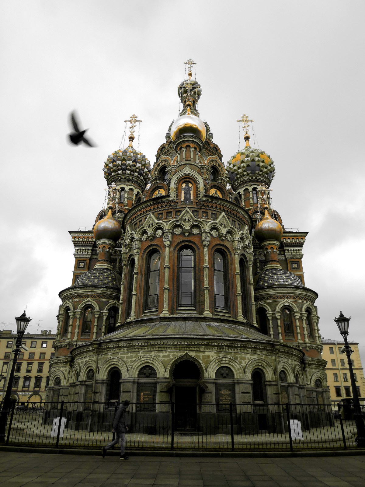
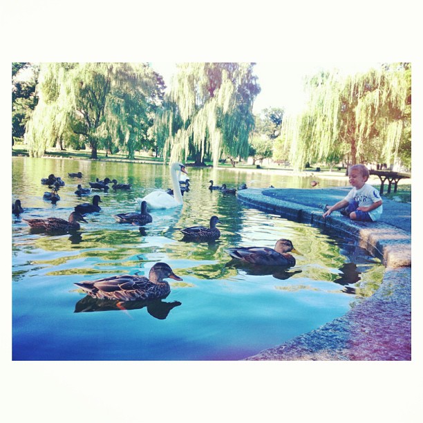
It’s been a while since I went out on a snowy, rainy day to shoot these. Spring has begun. The original  idea was to demonstrate exposure bracketing but as always, I learn much more. I shot three (3) sets of images, in the bracket, and chose to edit the +.7 EV set, using preview to adjust exposure, contrast and sharpness. For some reason, I found it easier to work up from dark to light. I could have also worked effectively with the 0.7 EV set but the -.7 were too bright.

Today, many filmmakers shoot digital with the most neutral camera settings to allow a wide editing latitude in post. I’m sure professional photographers do this as well.

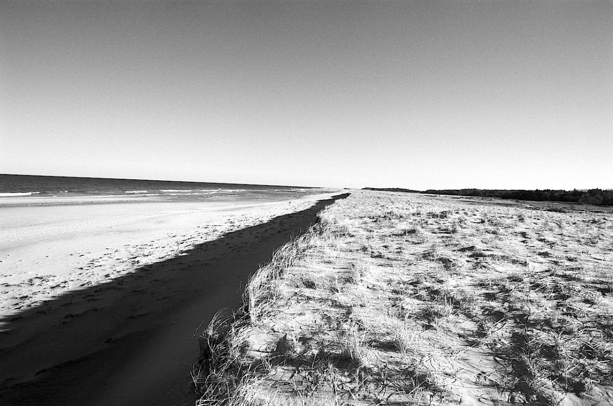
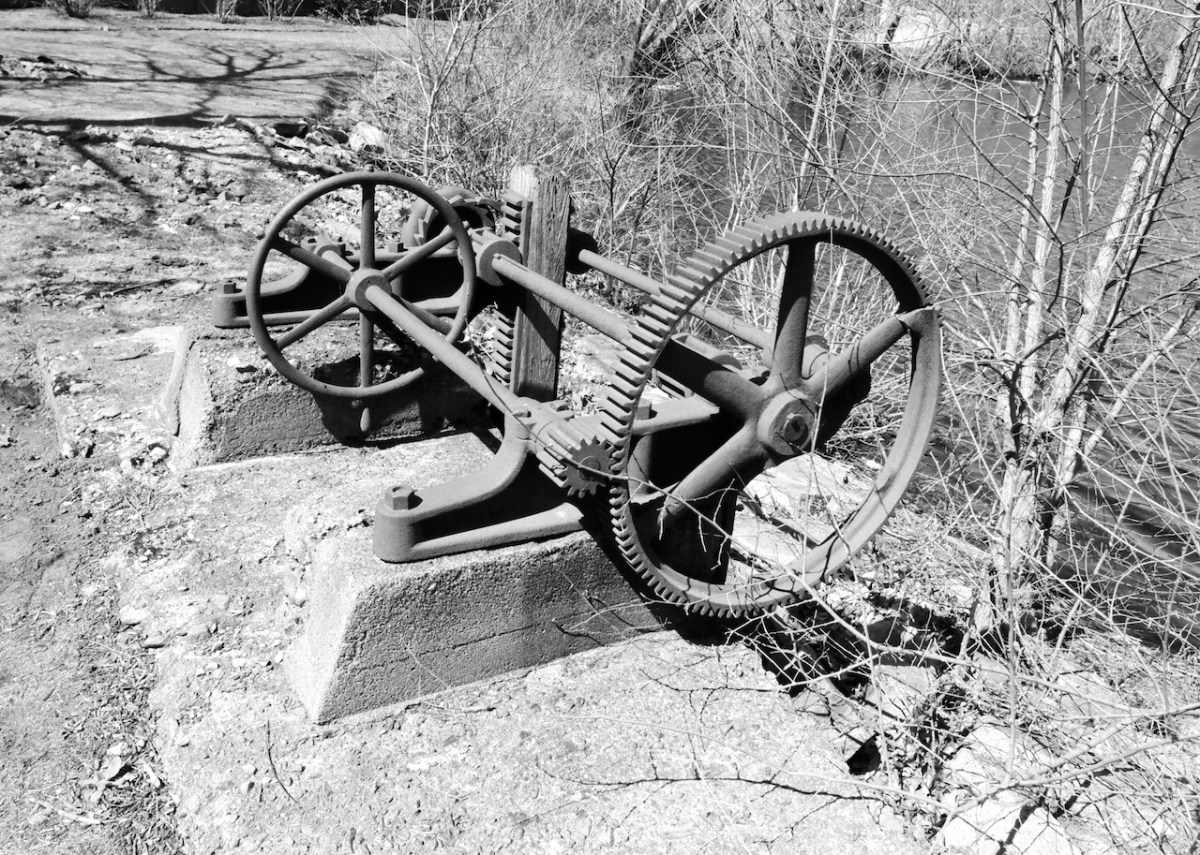
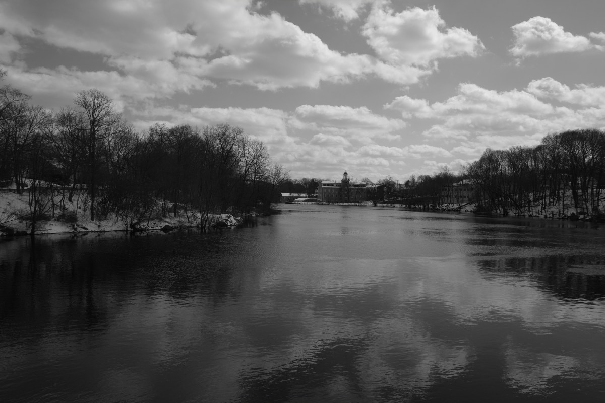
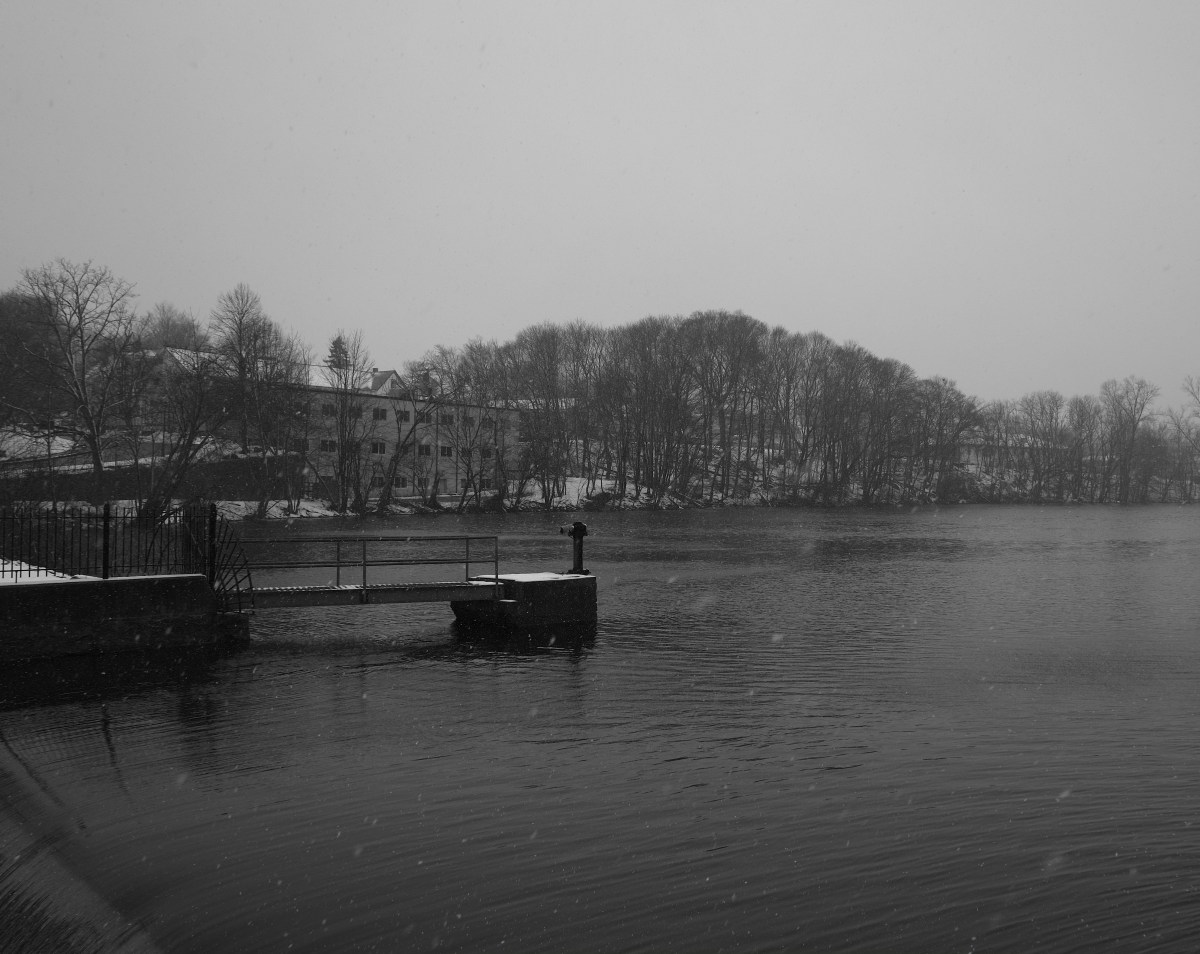
All these shots were taken with an Xpro1 and 18mm lens. I was a snowy, rainy day, as you can see, and you will actually see snowflakes, rain and the like in the images. lb

Note: click on the images for a more detailed view

A Little History…

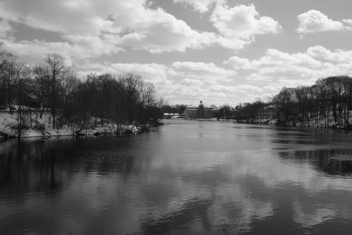
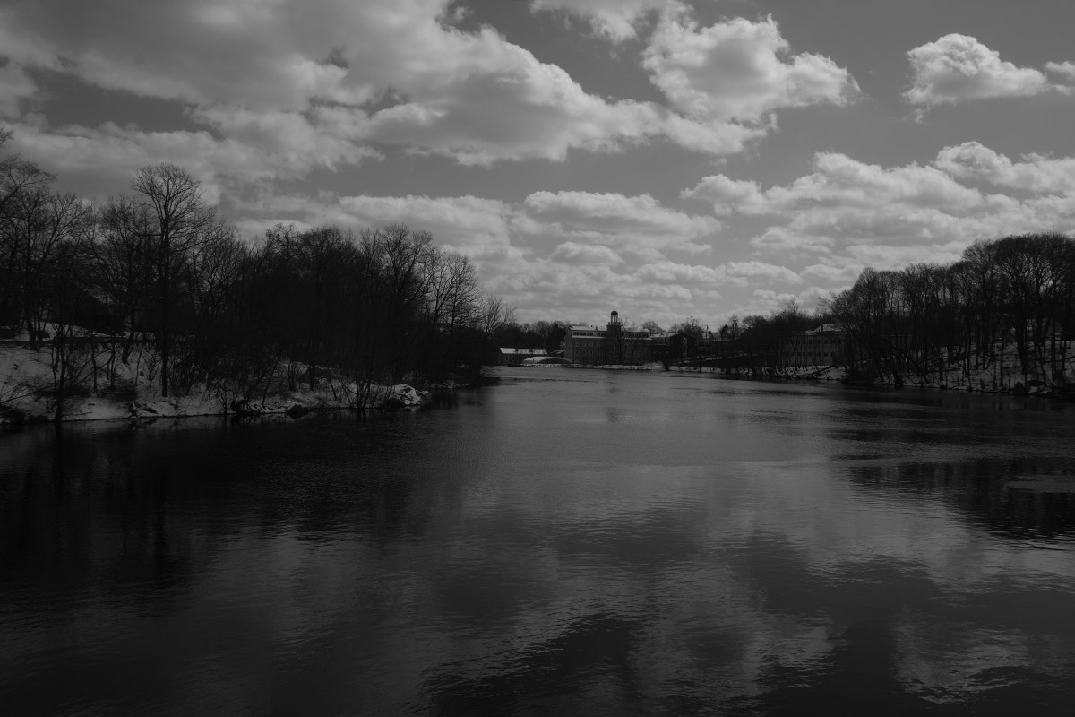
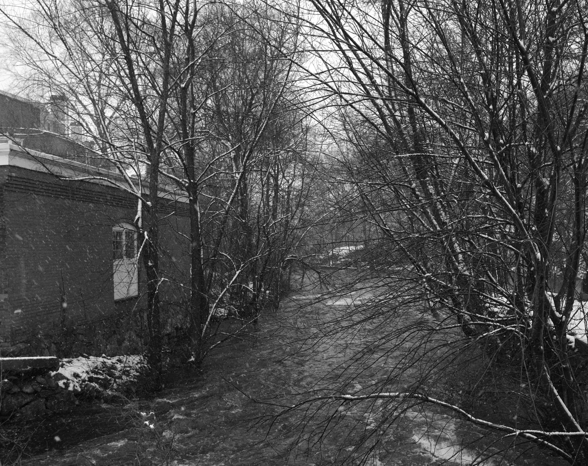
Mother Brook, dug through from the Charles River to East Brook in 1637, provided a connection with the Neponset River and a source of waterpower for the town’s all-important corn mill. In subsequent generations, that same waterway provided power to roll copper for American coins, to make paper (in three different mills), to support a brush factory and a wire factory, and to run the first water-driven broad powered loom in the entire world. These industries, combined with other enterprises around the town, gave a tremendous economic impetus to Dedham. By 1845, the town’s manufactories employed over 650 people, and produced such varied goods as cotton, cotton thread, woolens, silk, brooms, furnaces, shovels and hoes, paper, chairs and cabinets, tin ware, sheet iron, vehicles, boots, shoes, saddles and harnesses, cigars, pocket notebooks, and marbled papers. http://dedhamhistorical.org/history/
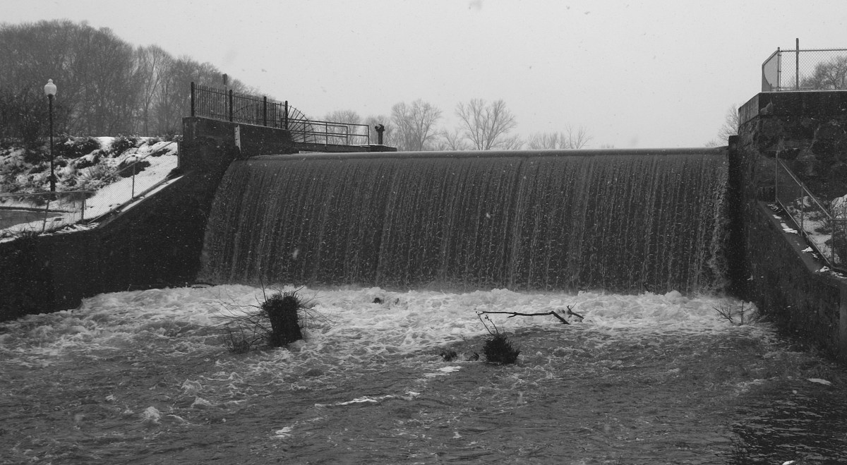
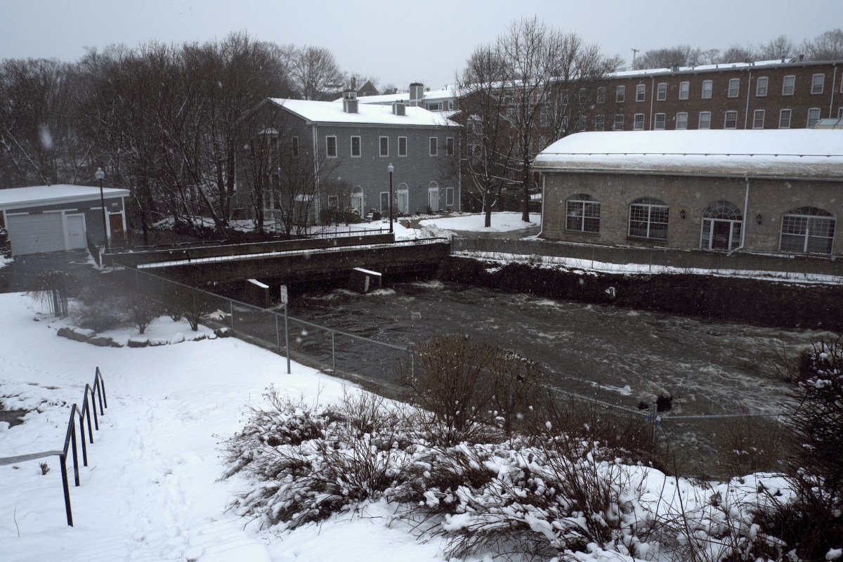
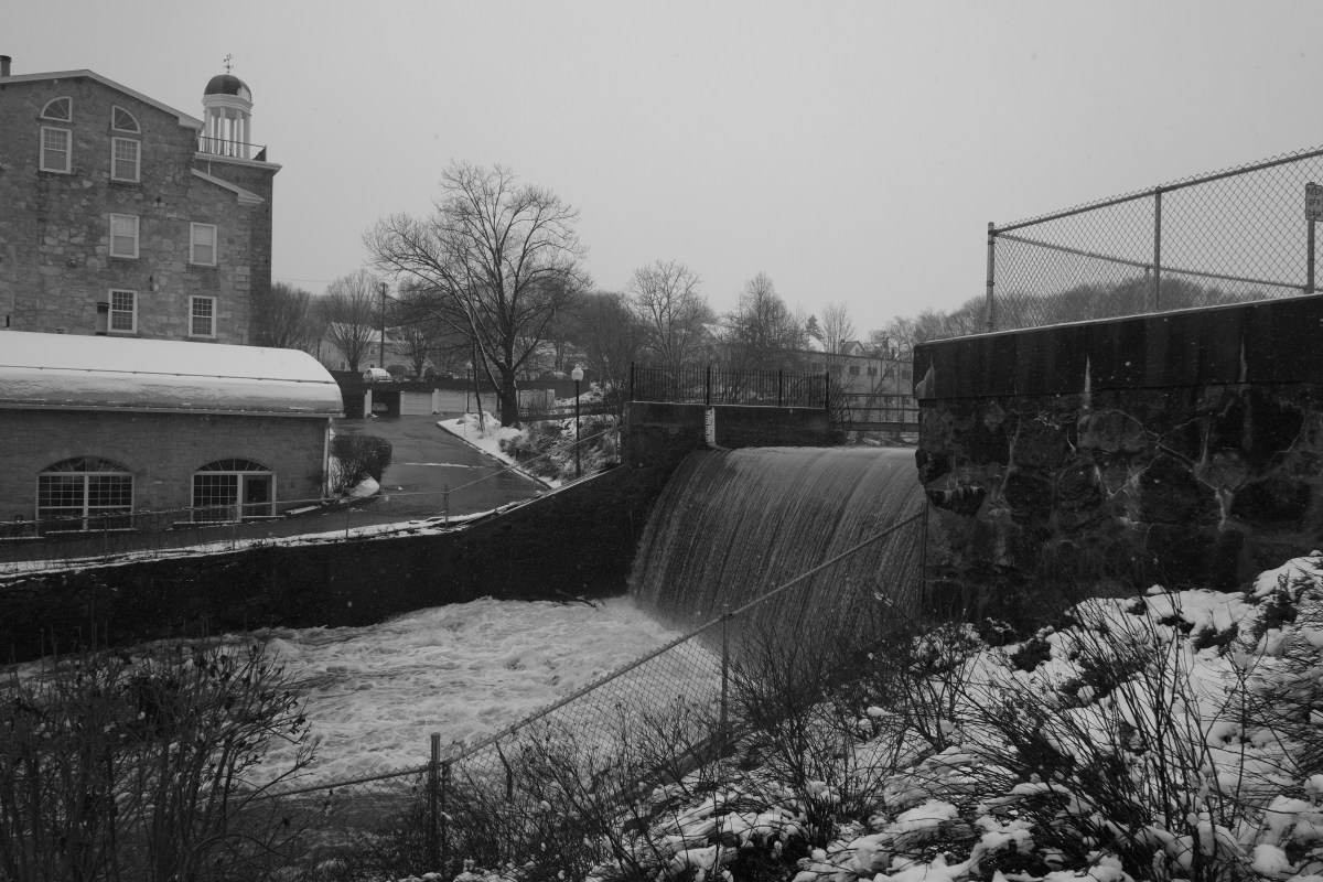
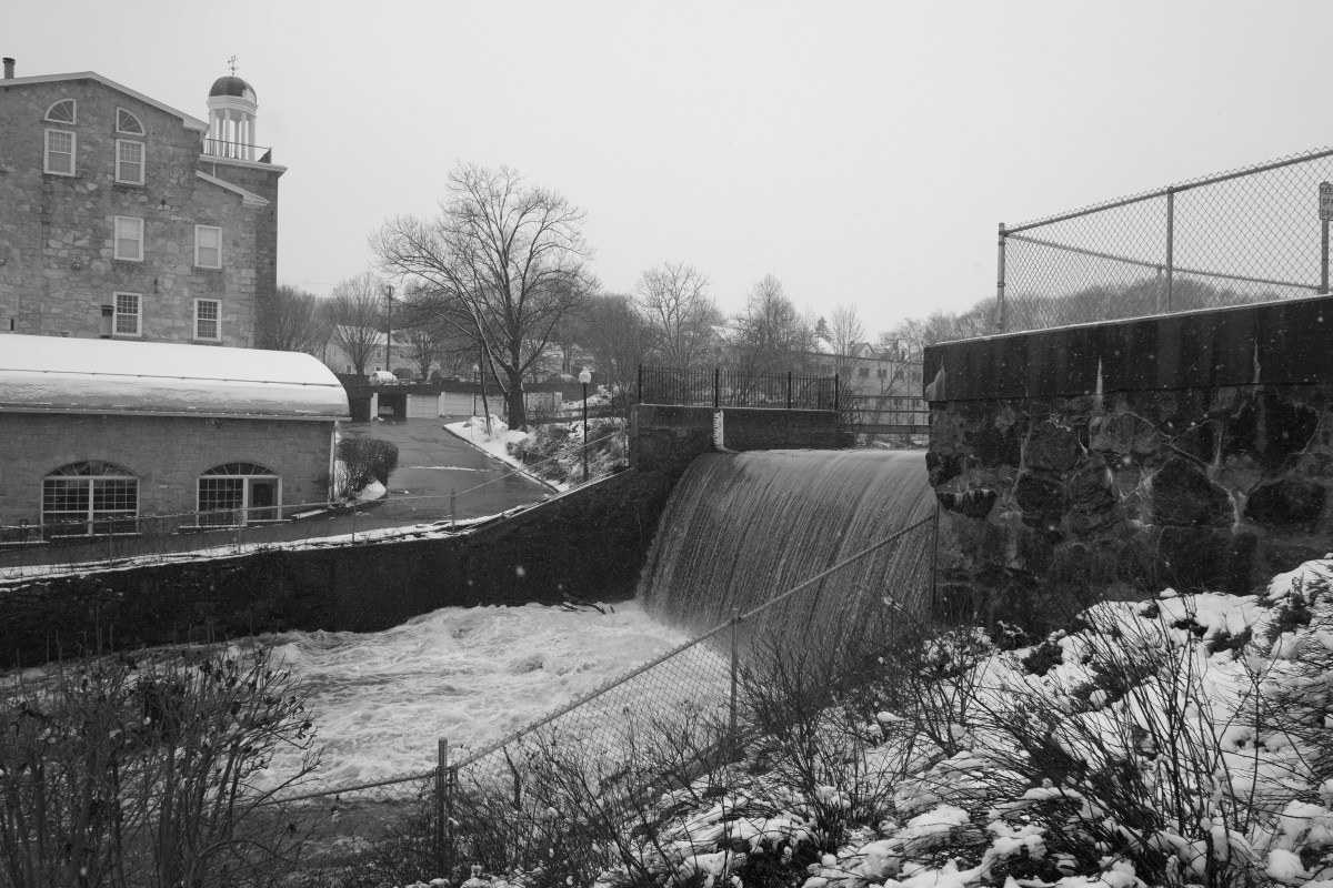
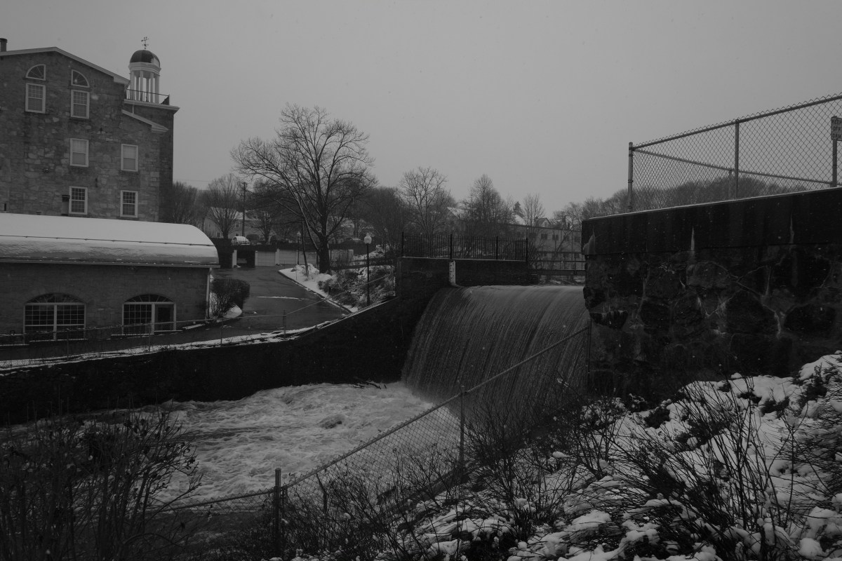
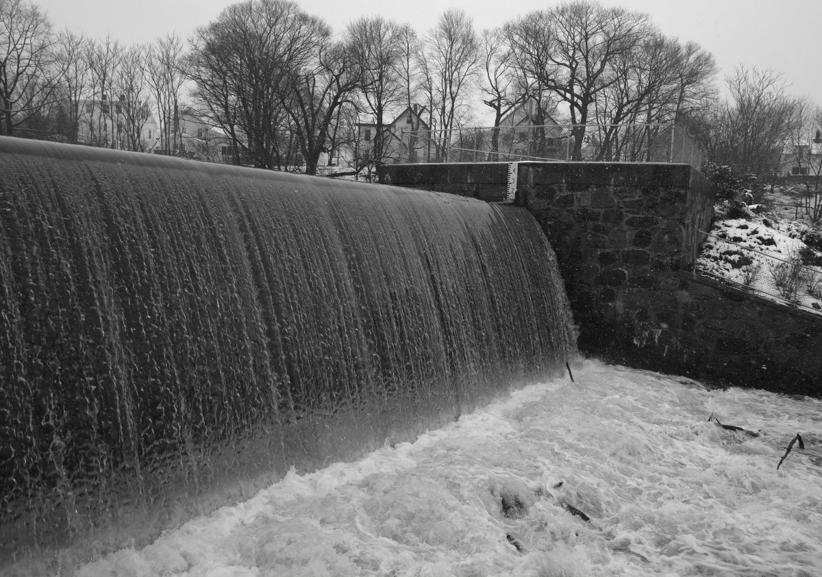
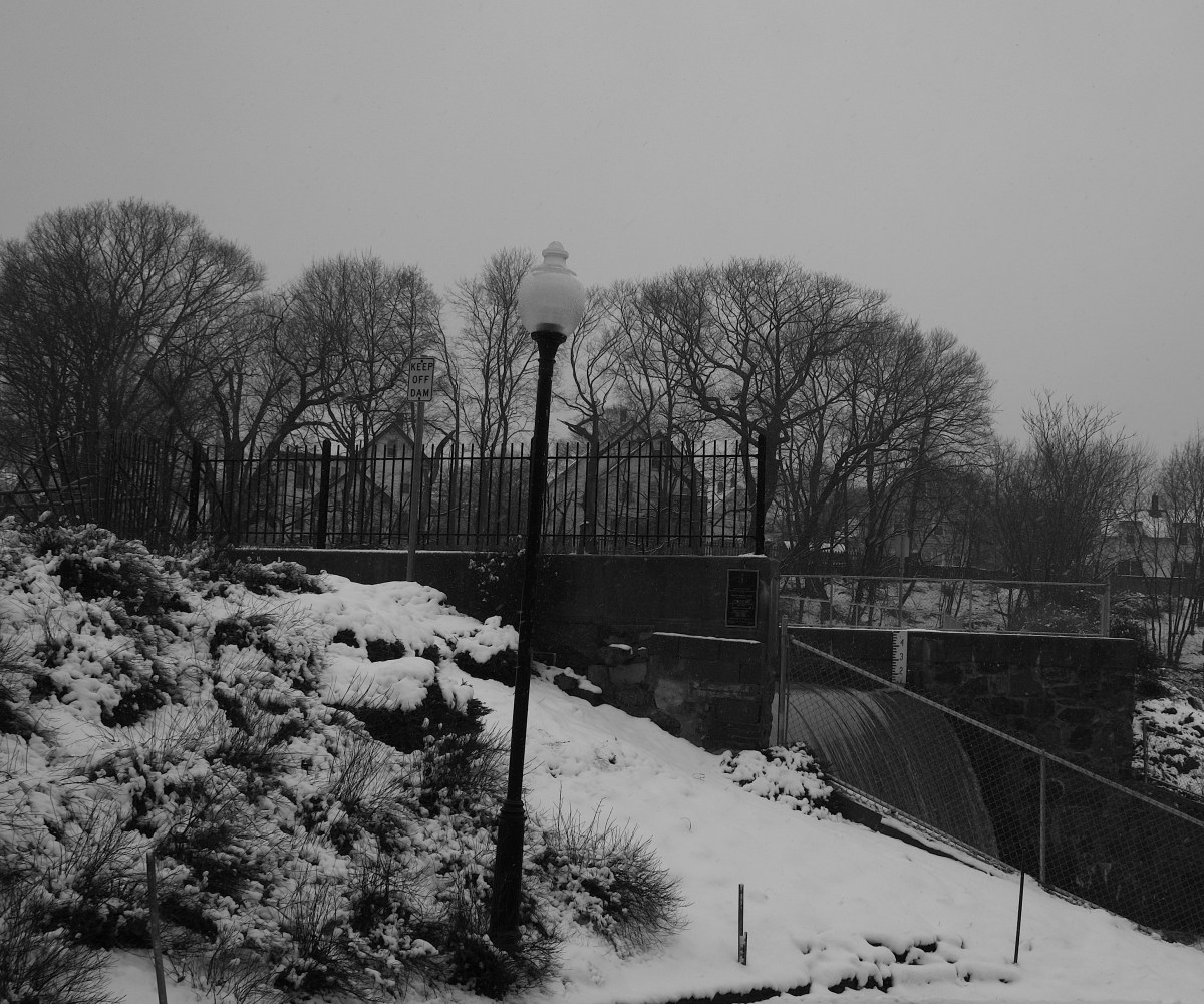
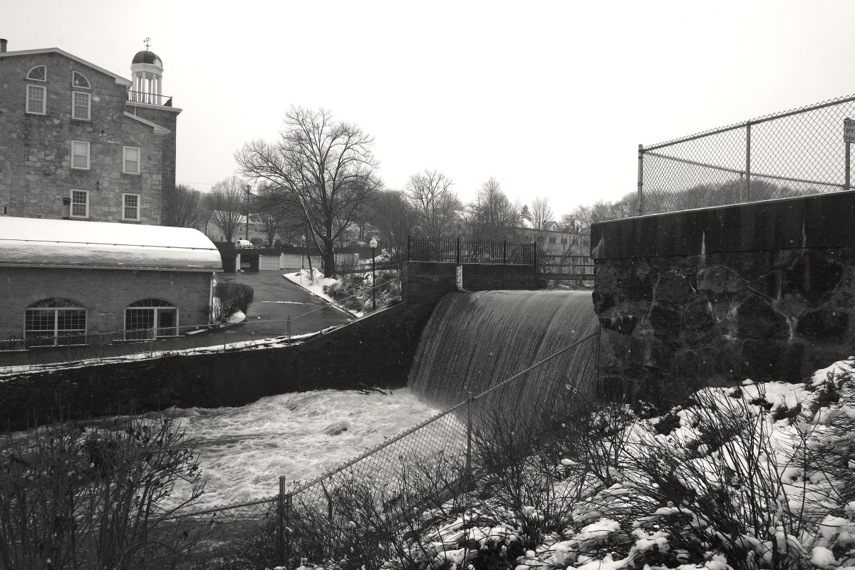
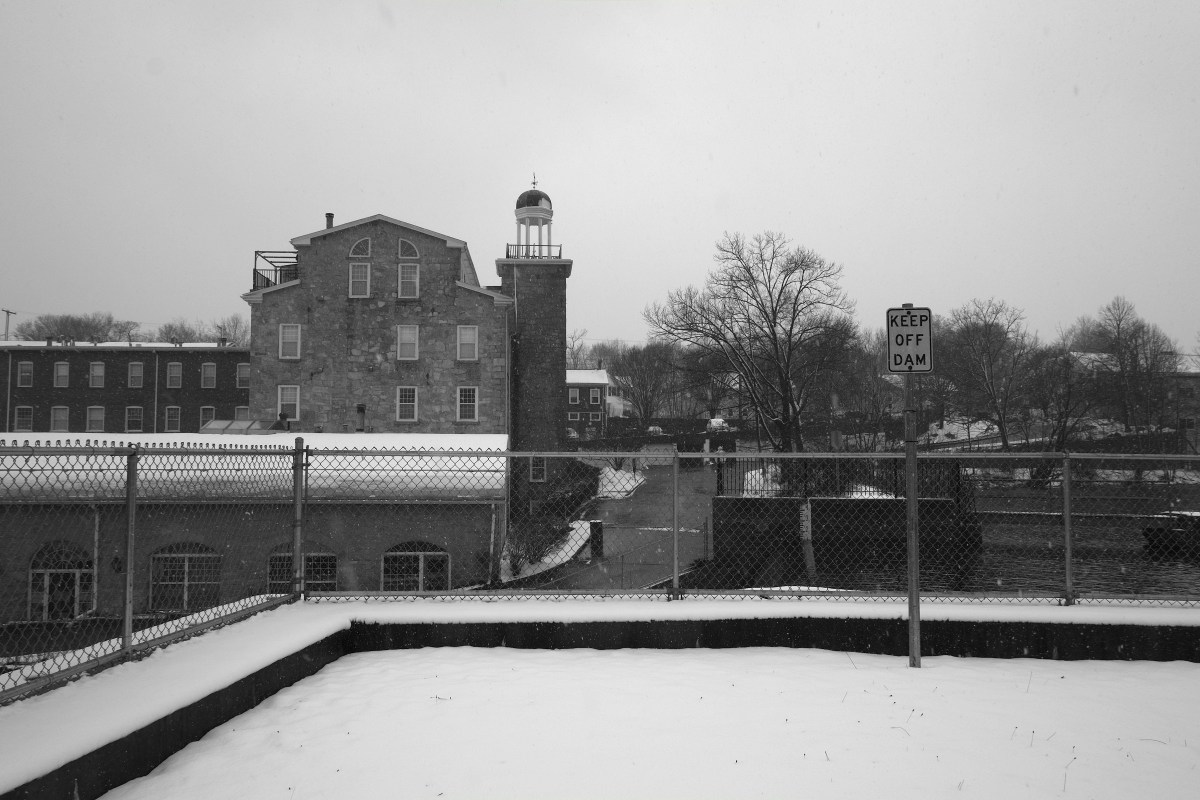
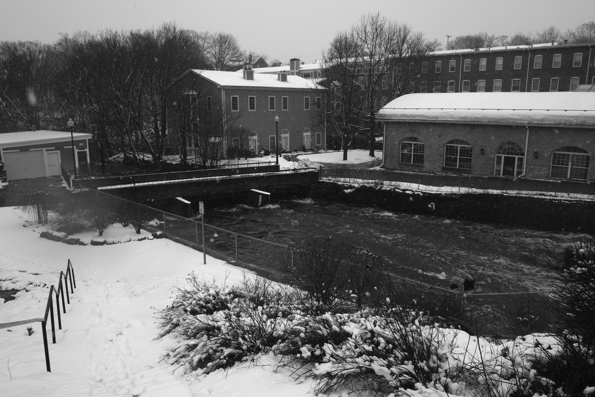
2013_0307ACCRUPLBRADY

Centennial Dam
This dam was originally constructed to provide water power to textile mills built at this site. This location was the fourth of five “privileges” (locations where dams could be built) along Mother Brook in Dedham, MA, first designated in Colonial times. Mother Brook connects to and drains the Charles River and empties into the Neponset River. A plaque mounted on the dam indicates that the current structure was built in 1894 and rebuilt in 1994. Earlier structures provided power for mills at this site since the early 1800s (and possibly earlier).
This is an embankment dam, with a spillway constructed of concrete with some stone and brick in the side walls. It is approximately 15 feet high.
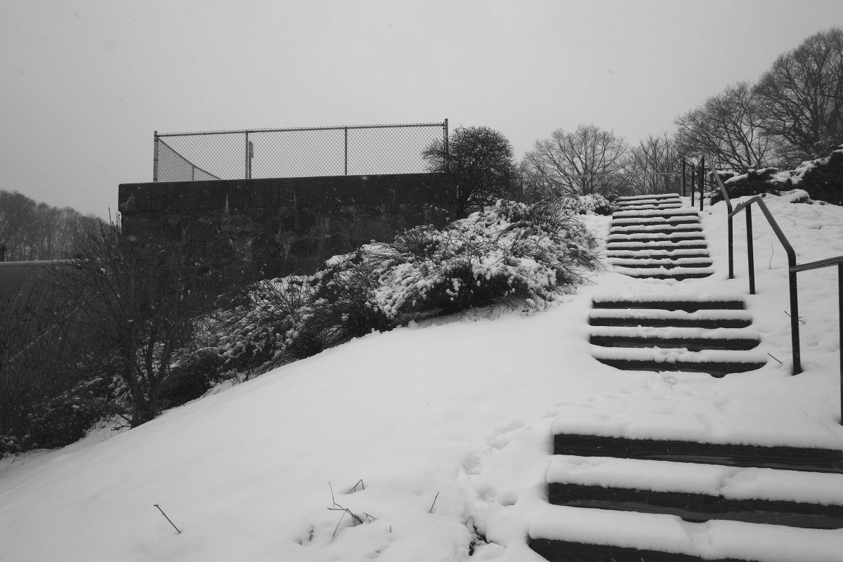
Fishing is done in the adjacent brook and pond, but signs in the area advise against eating certain types of fish due to PCB contamination.
Canoes or kayaks are rarely or ever used in the area because of limited water depth and limited practical travel distances.
The dam is adjacent to and effectively enclosed by property of the Mother Brook Condominium Association, a group of 86 residential condominiums. Several of the condo buildings were converted from mill buildings, in 1986-87.http://www.waymarking.com/waymarks/WMCY57_Centennial_Dam_Dedham_MA_USA
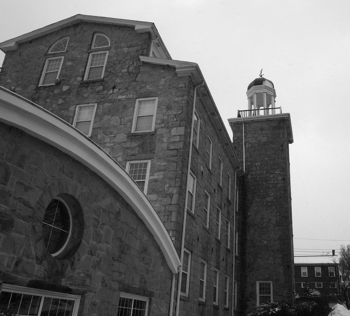
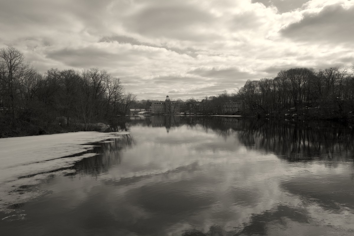
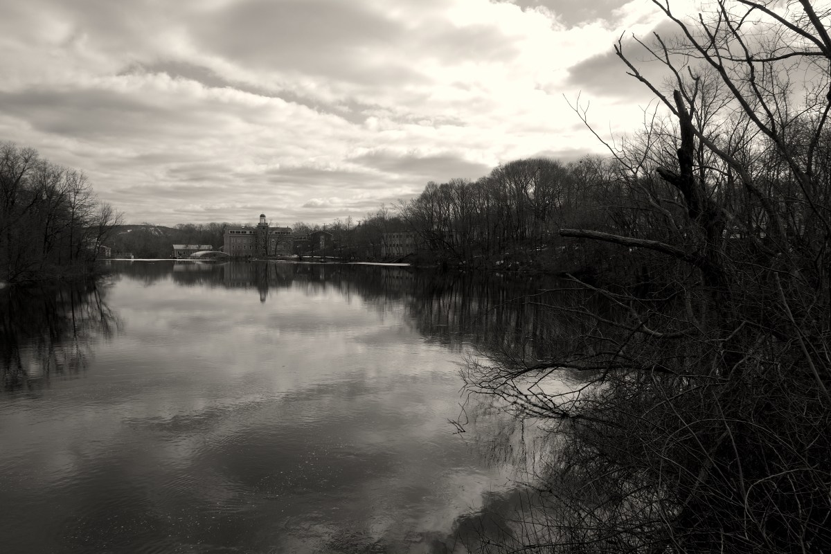
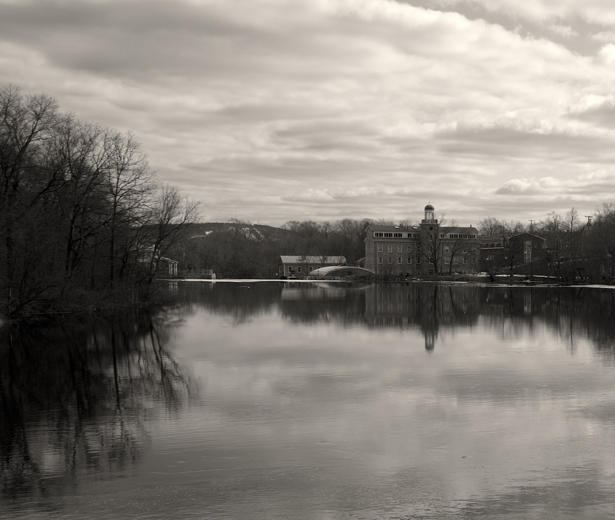
2013_0307AIUPCRLBRADY

2013_0307AUCRUPLBRADY

2013_0307AXCRUPLBRADY

Stone Mill
When built in 1835 for the Norfolk Manufacturing Co., this mill was powered by the adjacent Mother Brook flowing over what is now called “Centennial Dam.” It was initially used to manufacture cotton. The building was expanded by Mr. Thomas Barrows in approximately 1865-1870 and used to manufacture wool. It was sold to Merchants Woolen CO. in 1872, to Royal and Frederick Storrs in 1875, and again to Merchants Woolen Co. in 1882. In 1894 it was sold to Cochrane Manufacturing Co. and used to make carpets. At some unknown point, a steam plant was added, remnants of which remain in the basement of the building.
This mill is located at the fourth of five “privileges” along Mother Brook in Dedham where dams and mills were erected, beginning in Colonial times.
This building is now part of the Mother Brook Condominiums. It was converted to condos in 1987 along with several other former mill buildings on this site. http://www.waymarking.com/waymarks/WMCYJN_Water_mill_former_Cochrane_Manufacturing_Co_carpet_mill_Dedham_MA

2013_0307BDCRUPLBRADY

2013_0307BGUPLBRADY

2013_0307BMTPUPLBRADY

2013_0307BPUPLBRADY

2013_0307BYCRUPLBRADY

2013_0307CNUPLBRADY

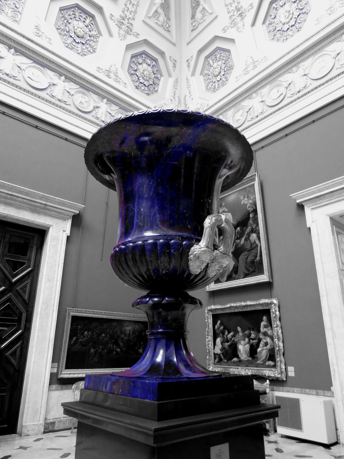
And for you guys and gals that must have a little color in your lives ;-).

2013_0307CNUP

Exposure Bracketing | return to Mother Brook | Leo Brady

Exposure bracketing is a simple technique professional photographers use to ensure they properly expose their pictures, especially in challenging lighting situations. When you expose for a scene, your camera’s light meter will select an aperture / shutter speed combination that it believes will give a properly exposed picture. Exposure bracketing means that you take two more pictures: one slightly under-exposed (usually by dialing in a negative exposure compensation, say -1/3EV), and the second one slightly over-exposed (usually by dialing in a positive exposure compensation, say +1/3EV), again according to your camera’s light meter.More at http://www.photoxels.com/tutorial_exposureBracketing.html

The above link is an excellent tutorial for those interested in learning more about and exploring the technique further.

For my tests, I chose a familiar subject, Mother Brook and added some shots of the dam at Stone Mill. https://realrealityproductions.wordpress.com/2013/03/05/stone-mill-mother-brook-dedham-ma/
I chose an auto exposure bracketing setting of 2/3, which produces an image of normal(0)EV, +2/3(+.7)EV and -2/3(-.7) EV. All these images are jpgs and have been shot large. I also shoot raw.  I’m looking for a certain balance of grays and a deeper black from my black and white images.  lb

Note: One thing that I never really thought about, with respect to auto exposure bracketing is how the images are shot by the camera (i.e. were three separates images with three different exposure settings produced or did the camera use the same image and somehow produce different exposure settings with the data from the one image, three times?). The camera produces three separate images which are three different moments in time. The image differences are indistinguishable in a static scene but not in a scene with movement. You can see this with the snowflakes in the second series of shots.

Example #1

It was a clear, sunny day. This set of three images below is a good example of what you can expect in good light from the Xpro1 when bracketing is set as mentioned above.

2013_0320ADFuji XPro1 18mm(27mm equiv.) f/13 @ 1/420s 0EV

2013_0320AEFuji XPro1 18mm(27mm equiv.) f/10 @ 1/420s +0.7EV

2013_0320AFFuji XPro1 18mm(27mm equiv.) f/16 @ 1/420s -0.7EV

Example #2

It was a gray, snowy day for this set of three images.

2013_0307BKFuji XPro1 18mm(27mm equiv.) 0EV

2013_0307BLFuji XPro1 18mm(27mm equiv.) +.7EV

2013_0307BMFuji XPro1 18mm(27mm equiv.) -.7EV

More images to come from the mill complex and dam.

Stone Mill & Mother Brook, Dedham MA | L Brady

DSCF0964UP
Fuji XPro1 18mm (27mm equiv.) lens F11 1/420 ISO 200 in B/W Mode *basic cleanup mods

DSCF0961UP
Fuji XPro1 18mm (27mm equiv.) lens F11 1/350 ISO 200 in B/W Mode *basic cleanup mods

DSCF0961UPcrop
Fuji XPro1 18mm (27mm equiv.) lens F11 1/420 ISO 200 in B/W Mode cropped from above, *basic cleanup mods

In Boston and the surrounding communities, many of the old mills still exist but have been converted. This is Stone Mill and Mother Brook.

All images here are shot with a Fuji XPro1 and an 18mm (27mm equiv.) lens in B/W Mode, large, high quality jpgs

*basic cleanup mods – I typically just use Preview to adjust exposure, contrast and sharpness if required. I’d like to start using bracketing more to eliminate even that but…